School Data
- Print
- DarkLight
- PDF
School Data
- Print
- DarkLight
- PDF
Article summary
Did you find this summary helpful?
Thank you for your feedback!
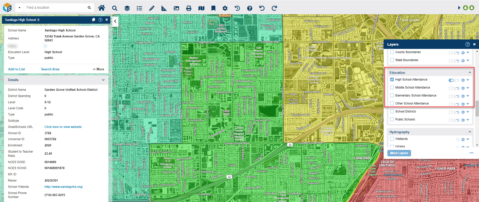
LightBox Vision provides many tools for analyzing land and property including visual mapping and insights into local schools. Available as an add-on are the school attendance zones. The map display shows the outline of the school district and the data within contains information about the schools, their grade levels, attendance, addresses, district info and more. Speak with an Account Manager to learn more about this premium add on.
School Attendance
Enable these premium layers to get a visual display that breaks down school information by grade range (High School, Middle, Elementary, other). Find out what the grade levels, addresses, and enrollment information are when you select its associated boundary to see the information on the parcel card as shown below.
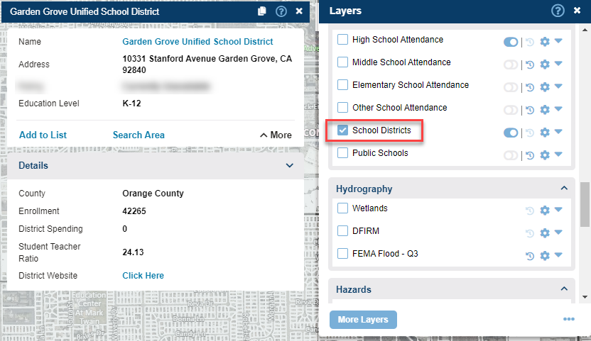
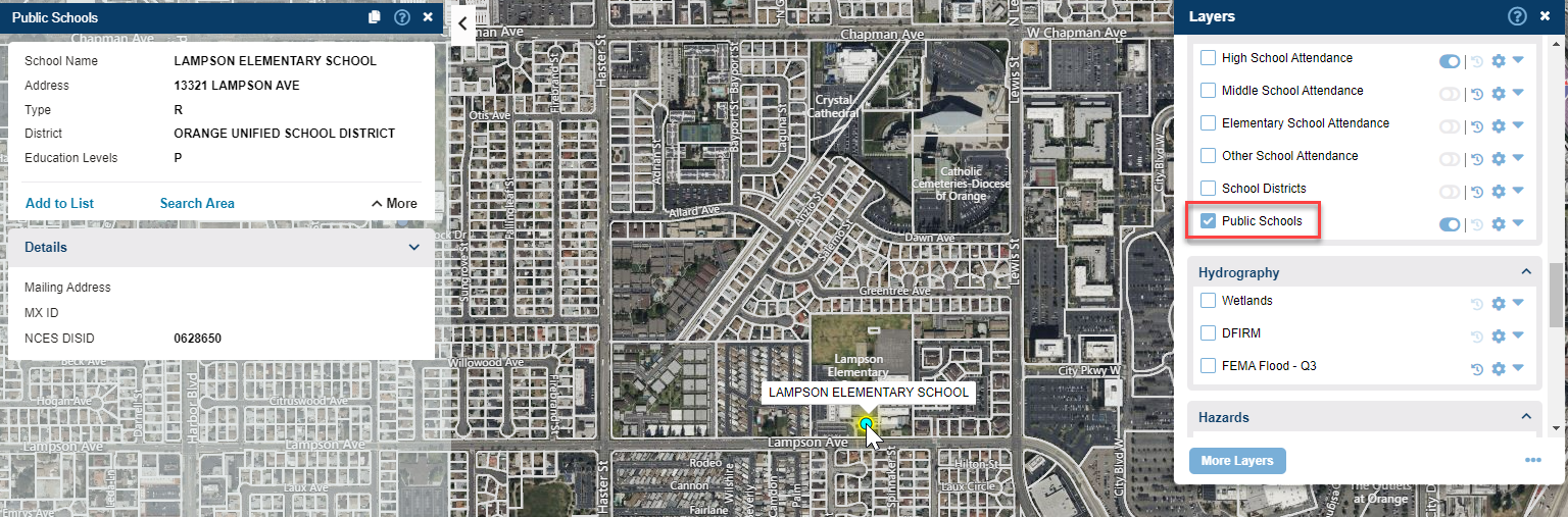
School Districts & Public Schools
Enable the School Districts layer to see an outline of the boundaries of a district as well as getting their name, address, and link to their site. You can also turn on the Public Schools layer to see the exact locations of schools on a map as a point layer. Find out how to get these additional layers of data on your account by contacting your LightBox Vision representative.
Was this article helpful?