- Print
- DarkLight
- PDF
Traffic Counts
- Print
- DarkLight
- PDF
LightBox Vision™ provides Department of Transportation traffic data as a nationwide data set. Whether you are looking for properties with high traffic around them to increase visibility or are looking for low traffic counts for ease of access to a property, LightBox Vision™ Traffic Counts will cover your needs.
Look for the "DOT Traffic" layers in your layers menu to get an idea of the traffic volume near the properties that you are looking at.
Traffic Count Layers
The Traffic Count layers behave similarly to many of the layers you are already familiar with in LightBox Vision. They can be moved in the Layers Panel to place them in the order that makes them easiest for you to find based on your needs.
For more information on how to use layers in LightBox Vision, Click Here.
LightBox Vision Traffic Count layers also come pre-styled for ease of use right from the start. By default, the AADT (Annual Average Daily Traffic) counts are represented by different colors on the map (first image below). However you can customize their look and feel by simply using the Edit Style option (second image below) for both the Traffic Counts data layer as well as the Traffic Counts Label layer.
| LightBox Vision Traffic Count layers also come pre-styled for ease of use right from the start. By default, the AADT (Annual Average Daily Traffic) counts are represented by different colors on the map (first image below). However you can customize their look and feel by simply using the Edit Style option (second image below) for both the Traffic Counts data layer as well as the Traffic Counts Label layer. | 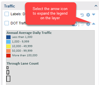 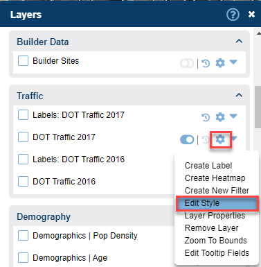 |
Traffic Tooltips
The Traffic Counts data layer also has the familiar Tooltip popup that by default will show the AADT (Annual Average Daily Traffic) number for that roadway by hovering your mouse over the lines on the road if your tooltip is enabled.
To learn more about enabling tooltips, Click Here.
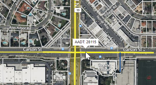
As with any Tooltip, this can be customized to show other or more detail that is available on that layer.
Searching on the Traffic Layer
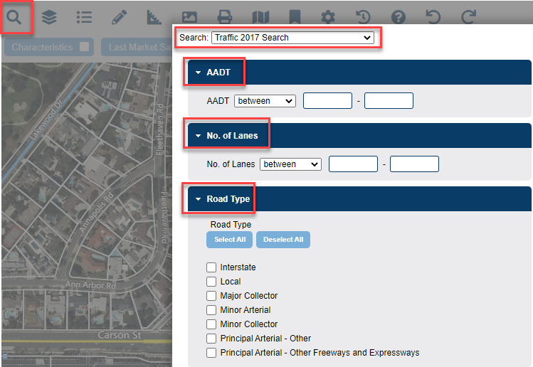
The DOT Traffic 2017 layer can also be searched by certain specifications in order to look for target properties with two built-in filters.
- The AADT or Annual Average Daily Trafficfilter can be used to find roadways with a specified traffic count.
- For Example: AADT = 10000
- The No. of Lanesfilter will let you search for roadways with a specified amount of lanes.
- For Example: No. of Lanes = 4
- The Road Typefilter will let you search for roadways based on how they are classified
- For Example: Road Type = Interstate
Identifying Properties Around the Traffic Layer
Users can search for properties within a set distance from the traffic layers. See the below steps for details
1. Turn on one of the traffic layers by selecting the Layers icon and choosing either of the traffic layers in your Layers Menu. Colorful lines will now display on roads.

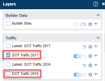
2. In the Main Toolbar, make sure you choose the Property Search filter and click OK at the bottom of the form.

3. Next, click directly on the segment of the roadway you want to use (it will turn a green color when identified) and click the Search Area command on the Information Panel.
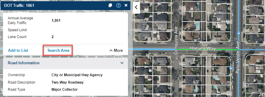
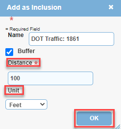
4. At the Add as Inclusion window, fill in the fields needed (Distance & Unit type) for the settings.
5. Choose any specific types of properties you need to find by choosing the checkbox next to that category and selecting a specific requirement (or leave all unselected to retrieve every property within the buffer).
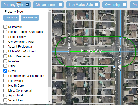
6. Choose the Apply Filter button to the top right of the screen to execute the search.

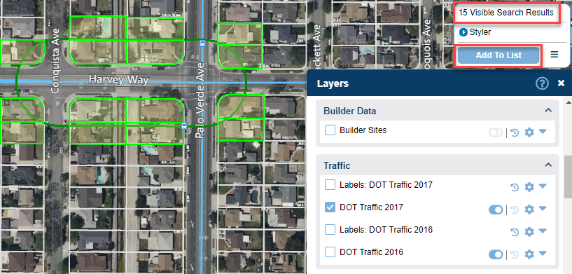
7. Your search result total will provide the amount of properties in your buffer that fit your chosen criteria and these will highlight in green. Choose Add to List to view the details of these.
.png)

.png)