LightBox Vision Zoning
- Print
- DarkLight
- PDF
LightBox Vision Zoning
- Print
- DarkLight
- PDF
Article summary
Did you find this summary helpful?
Thank you for your feedback!
NOTE:
The LightBox zoning data layer is available as an add-on to LightBox Vision. Please contact your LightBox Vision representative to add zoning data to your account.
Zoning Overview
Zoning data is a critical piece of the decision-making process for CRE, broker and builder/developer markets. It provides insights into what a property is zoned for, zoning districts, setback requirements, floor area ratio (FAR), building height, and more. This data, when utilized with LightBox Vision’s powerful property analysis tools, offers customers a more robust view of parcels without the time consuming, costly, and tedious collection of zoning information. Having this dataset may even serve to bring this part of a client's workflow in-house so that the data collection does not have to be outsourced.
LightBox Vision Zoning is a nationwide data layer that can provide insights into:
What a property is zoned for
Zoning districts
Setback requirements
Density/floor area ratio (FAR) requirements
Building height requirements
Permitted uses
Governing jurisdiction information
For more information, please see our FAQ page.
Zoning Overview Video
(Best viewed at full screen)
The LightBox Method
LightBox zoning data is collected at the jurisdiction level on a national scale. Our dedicated zoning data acquisition team researches jurisdictions in a target area one-by-one, looking for the zoning ordinance and zoning map for each.
When a zoning map source is located, it is overlaid with parcel data in-house. This will allow users to know the zoning code for a specific location. By using the zoning code from the zoning governing jurisdiction, users can access the corresponding ordinance details we have collected.
Zoning Data Layers
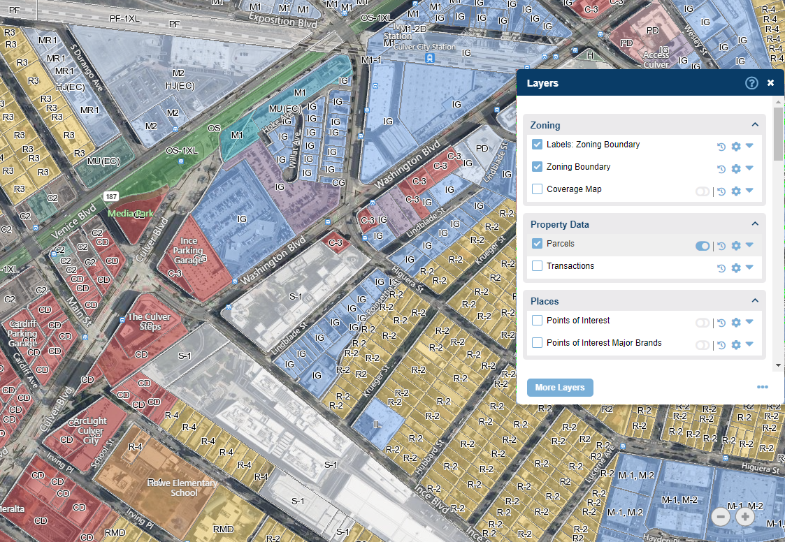
To view and toggle the Zoning Data Layers on/off, click the Layers icon on the toolbar. |
|
In the Zoning section there are several options that can be toggled on or off visually on the map:
|
|

.png)
LightBox Vision Zoning Card
The Zoning Card is a new addition to the Property Panel where users have the ability to get a comprehensive view of the zoning data to help understand zoning requirements and better assess opportunities.
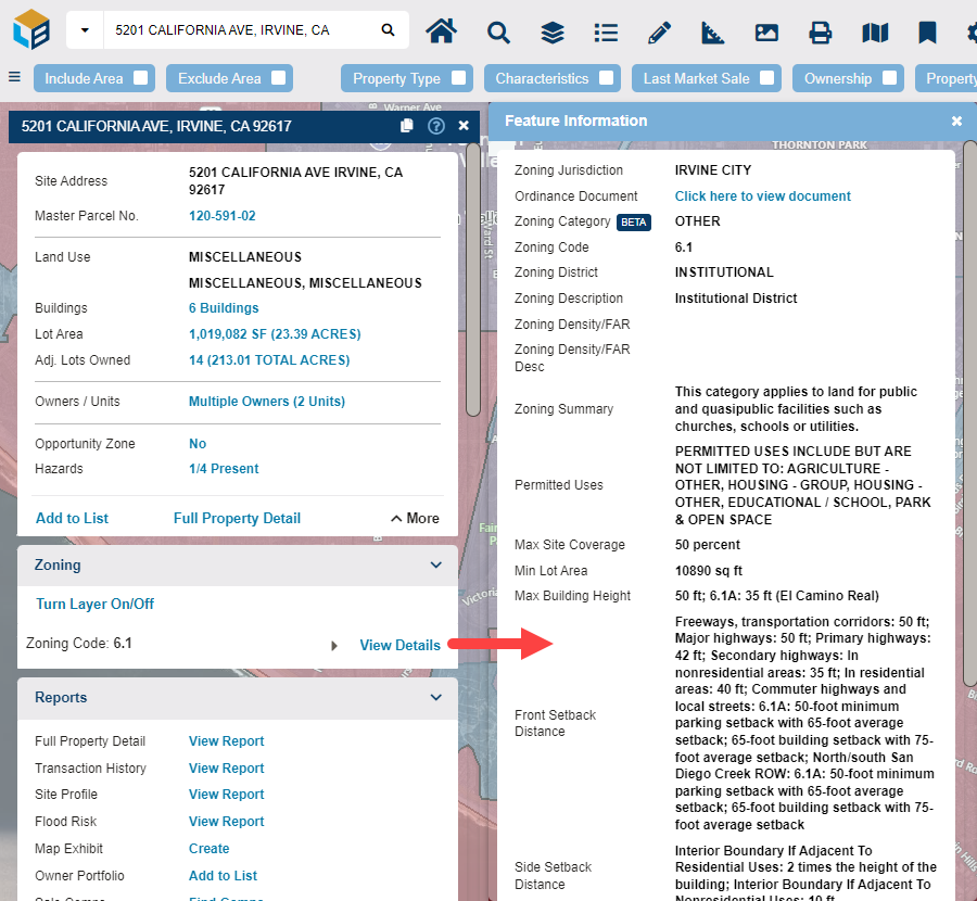
Field Name | Example |
Zoning Jurisdiction | City - Chicago, IL |
Ordinance Document | Hyperlink to municode.com - Offers more detailed county level zoning information |
Zoning Category | Office, Residential, etc. |
Zoning Code | R-80, C2-1VL, etc. - This is dependent on individual counties |
Zoning District | Commercial |
Zoning Desc | Neighborhood Commercial District |
Zoning Density/FAR | 2.0 |
Zoning Desnity/FAR Desc | 2.0; 1 du/acre |
Zoning Summary | "To provide for the development of regional-serving retail, personal service, and office uses. This district is not intended to be located in areas of low density residential development." |
Permitted Uses | Permitted uses include but are not limited to: Religious Facility, Gas Station, Bank, General Retail, Housing - Group, Housing - Multiple Units, Housing - Senior, Housing - Student, Office, Educational / School |
Max Site Coverage | 60 percent; Aboveground parking structures are included in lot coverage calculations; surface parking lots and underground parking structures are not. |
Min Lot Area |
|
Max Building Height | 30ft, 2.5 stories |
Front Setback Distance | 10 ft; 20 ft from a residential district |
Side Setback Distance |
|
Rear Setback Distance |
|
Ordinance as of | 5/30/2019 |
Boundary as of | 4/21/2020 |
Zoning Boundary Type | Base |
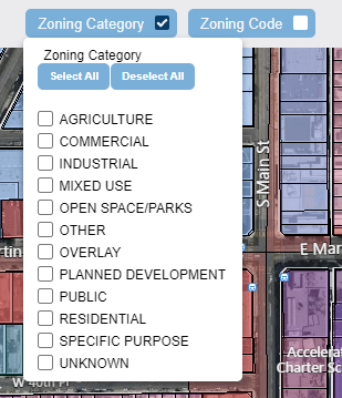
Searching the Zoning Data
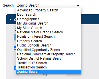
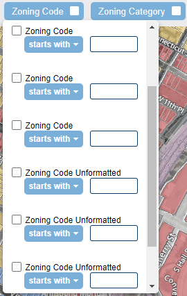
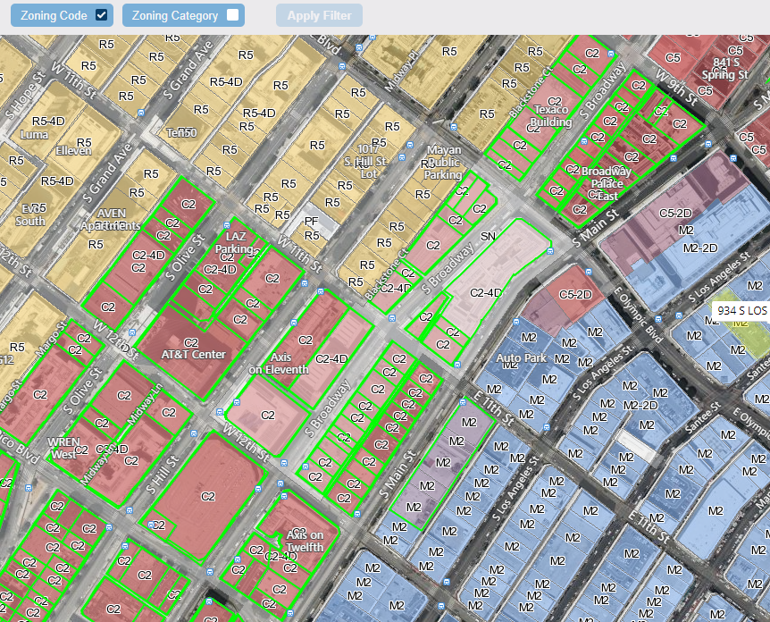
Areas where zoning information is available can be searched for by Zoning Code and/or Zoning Category using the Zoning Search and filters.
Step 1: Opening the Zoning Search
|
|
Step 2: Entering Search Values
-AND/OR-
|
|
Step 3: Search ResultsThe search result zones that match the search filter criteria will be outlined in green by default. |
|

Was this article helpful?